🥾 Walk 474 - Hungerford and Ramsbury
The August Bank Holiday had a rather autumnal feel to it as six of us gathered in Hungerford for a 12.5 mile walk to Ramsbury and back. We soon warmed up as we got going on the walk, which started by crossing through the town on Church Street and then Parsonage Lane before entering the grounds of St Lawrence Church.
Next, we crossed the Kennet and Avon Canal on a swing bridge, the other side of the church, and followed the River Dun to Freeman's Marsh. Crossing the A4 Bath Road we marched uphill through farmland, then through woodland before downhill into the village of Chilton Foliat, crossing the River Kennet on the way.
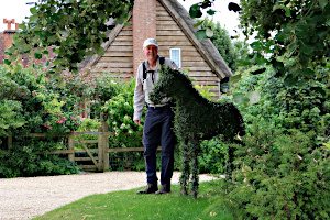
Next came a long track, rutted and overgrown, steadily gaining height to Crooked Soley. Walking through this hamlet, we spotted a topiary horse in someone's garden. There were no gates or fences, so our intrepid leader strode up the driveway and posed for a photo of him stroking the horse.
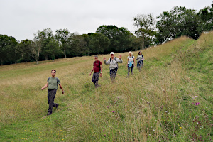
Leaving Crooked Soley, we passed through Foxbury Wood, Fewley Coppice and Balaam's Wood, crossing a fair number of contour lines on the map. These were just some of the undulations mentioned in the leader's walk description.
Crossing farmland, we descended into the tiny hamlet of Whittonditch. Then we followed the Whittonditch Road into the village of Ramsbury. The charm of the village became more apparent as we approached the centre, where we found old cottages, pubs and a large church without a spire.
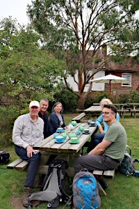
We stopped here to eat our packed lunches, then had a look inside the church before stopping for tea at a local cafe. The leader was particularly delighted by the cafe garden as it contained a Eucalyptus tree, much like those native to his homeland of Australia.
While enjoying our cups of tea, we took stock of the walk so far. We were at the furthest point from the start of the walk and yet we seemed to have already done 8 miles of the 12.5 mile walk! Ian assured us that the route back was more direct, but there was much (friendly) banter about Ian's reputation for frequently underestimating the length of his walks.
With the tea drunk, and us sober, we left the cafe and Ramsbury. After crossing the River Kennet, we followed a long and undulating footpath through farmland and woodland to Froxfield. Here we joined the Kennet and Avon Canal, which we followed into Hungerford, passing the swing bridge we'd crossed when we'd set out and continuing along the canal until it passed under the High Street. See our route on Google Maps.
Consulting my GPS after the walk, we'd covered a distance of 13.4 miles, which is only 7% over the stated mileage, so Ian was vindicated. However, the total ascent throughout the walk added up to 700m (2,300 ft) which is a fair amount of undulation!

Thank you to Ian for leading this walk.
📸 Back to Volume 37
Return to volume index