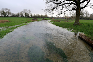
Our previous walk was on Saturday 8th February, the day before Storm Ciara hit town. From that day, every walk in our programme had been cancelled due to storms and/or flooding. In fact, the walk we were supposed to be doing today (Saturday 7th March) along the Thames Path, had also fallen victim to the flooding and had been cancelled. So I came up with this walk as a last minute substitute.
I decided to lead a walk that was outside the Thames Valley and in an area I was familiar with, so that I could make ad-hoc changes if paths were waterlogged. I was a little disappointed when only two people joined me for the walk, but in some ways I was relieved that I didn't have a huge party with me in case we ran into trouble with flooded paths on the route.
The three of us set off from Hook railway station and crossed the village along roads and alleyways to get to Holt Lane. This was the best route through Bartley Heath, which is boggy enough during a normal winter. Crossing the M3 motorway on a footbridge, our first challenge was the woodland path to North Warnborough. Every dip in the path was full of water, so frequent detours were required.
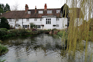
Next we followed a service road to the farm shop and then joined a footpath that followed the River Whitewarter. I had been nervous that this would be tricky, but despite the Whitewater being deeper and wider than I'd ever seen it, the footpath was fine. Crossing the road by the Mill House restaurant, which is built over the river and still has a water-wheel within, we stopped to look at the river level as it emerged from under the building. It was unusually high.
We followed the lane through Warnborough Green, where we encountered a number of highland cattle, who casually observed us as we passed by. The lane crossed the River Whitewater at a ford with a footbridge. The water was very high but not quite up to the bridge, so we were okay.
Joining the Basingstoke Canal at the swing bridge, we were relieved to see the canal was at its normal level. We followed the tow path to King John's Castle, where we stopped to have a look around and read the information boards. Continuing our route, we followed the canal towpath as far as the entrance of the Greywell Tunnel. Here we left the canal and popped into the Fox and Goose for a pint and a warm up by the log fire before heading up Greywell Hill. There was a massive trunk of a fallen oak tree to sit on while we ate our packed lunches and admired the view.
After lunch we followed the route of the tunnel through the woodland above it. Dropping down to the other entrance of the tunnel we followed a path that ran alongside an un-restored section of the canal that was now a nature reserve. Crossing the canal at the next bridge, we made our way to the hamlet of Up Nately.
We crossed back over the canal at another bridge and followed a track through woodland up to the M3. Here we passed over the motorway on a road bridge and followed the lane through farmland on our way to Newnham.
It was once we reached Newnham that the paths got really muddy. Firstly we crossed a very wet field at Owen's Farm and then followed a very muddy path back to Hook. Finally we were back in the village and we rinsed our boots in a stream and we had nice dry pavement back to the station. See our route on Google Maps.

My two companions on this walk had not walked in this area before and seemed to enjoy exploring it. Also the weather was relatively kind to us, with no rain at all, and a few glimpses of sunshine along the way.

Return to volume index