Sunday 23rd June saw twelve of us (a mix of newcomers and regulars, plus members of other Ramblers groups and Meetup) assemble in Pangbourne on a warm but overcast day. The walk was one I'd led before, but with a slight modification to the route so as to include the hamlet of Sulham.
We started by following a lane that became a footpath running parallel to the River Pang, then crossing fields and joining Sulham Lane. After following the lane for a short distance, we crossed a wheat field and entered Sulham Wood. Here we had a steep but brief ascent to another path within the wood, this one taking us to the adjoining Mosshall Wood.
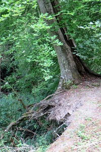
The path followed the top of a sort of cliff, where the land had fallen away, leaving some trees hanging on to the remaining soil for dear life!
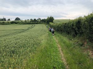
Leaving the woods, we crossed fields of barley and then pastures on our way to Little Heath. Doubling back along Kiln Lane, we passed through woodland and then more fields, some pasture and some crops, until we joined Nunhide Lane. This passed Sulham House, St Nicholas Church and a splendid looking thatched gate house at the end of the lane.
A footpath took us on a route parallel to Sulham Lane for a short while before we crossed the lane and made our way toward Tidmarsh. Stopping by the Pang river for our picnic lunch, we then popped into The Greyhound for a drink before continuing with the walk.
The last part of the walk passed through more wheat fields near Gregory's Hill and then up into the grounds of Pangbourne College. Leaving through their front entrance, we did a short stretch of road walking before crossing more fields of barley. As we reached Berry Copse, we could see a large field of opium poppies in the distance.

A wooded route took us through Berry Copse to Sots Hole, where we joined Shooters Hill (road), which we followed back into Pangbourne. See our route on Google Maps.
Thank you to Jason for taking some of the photos and for publicising my walk on Meetup.
Return to volume index