🥾 Walk 190 - Watership Down, Ecchinswell and Kingsclere
I led a walk on Sunday 18th October from White Hill, near Kingsclere. Twelve people and a dog called Fido came along for this walk, which was made out of bits of other walks I'd already led around that area, plus a new bit in the middle to join it all up.
We set off along the Wayfarer's Walk, heading west. The Wayfarer's Walk is a 70 mile path from Ink Pen, near Walbury Hill, down to Emsworth, on the south coast. We only followed this route for about a mile and a half, over Watership Down, as far as Nuthanger Down. Along the way we could see the Sydnonton Estate below us and further in the distance we could just see Newbury.
We descended to the hamlet of Sydnonton, which we walked through before passing Watership Farm on our way to Ecchinswell. At the edge of the village we took a scenic route looping up and around Nuthanger Farm, stopping to look at the raised barn that is mentioned in Richard Adams' book, Watership Down.
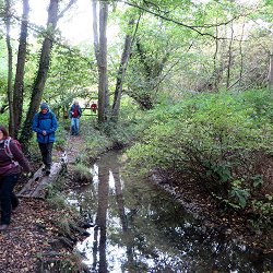
After stopping for our picnic lunch at the edge of a field near Nuthanger Farm, we continued our route into Ecchinswell, where we stopped at the Royal Oak pub for a drink. Suitably refreshed we left Ecchinswell, heading east into Frobury Park. We passed the fish ponds, surrounded by anglers, and headed south. We crossed Ecchinswell Road and continued south through farmland.
Perhaps it's time I confessed that I hadn't pre-walked this part of the walk and as a result, I made a wrong turning. Luckily we didn't go very far before I realised my mistake. Back on the right track, we touched the southernmost tip of Kingsclere before heading south across the gallops and up the steep path through the woods to the top of Cottington's Hill. From here it was just a short walk back to the car park. See our route on Bing Maps.

📸 Back to Volume 14
Return to volume index