🥾 Walk 90 - Kingsclere, Ecchinswell and Watership Down
On Sunday 23rd February we should have been walking around Pangbourne, but the swollen Thames put a stop to that, so instead we chose to walk on the North Hampshire Downs - well away from the Thames Valley.
Thirteen people turned up at the car park on White Hill, near Watership Down, to be greeted by strong winds and fine drizzle. The walk started by heading up Cottington's Hill where the Hannington transmitter mast radiates digital television to North Hampshire and Berkshire.
Skirting past the transmitting station, we then took a diagonal path down the steep slope of Freemantle Park Down and on to the gallops that belong to Park House Stables, just south of Kingsclere. Down here there was less wind and the drizzle had more-or-less stopped.
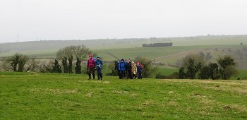
We followed the public footpath past the gallops to Kingsclere. There we turned west onto Hollowshot Lane, which emerged onto Swan Lane on the southernmost tip of the village. A short bit of road walking took us to another footpath that ran west over Bishop's Hill. From here we had a very clear view of Watership Down, which we would be walking atop on our return.
Another short bit of road walking took us to the fishing lakes at Frobury Farm where there were a few fishermen. The footpath that circumnavigates the fishing lakes is actually lower than the lakes themselves. Needless to say, it was very muddy and slushy.
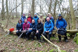
We stopped for our picnic lunch in Southwood Copse where we conveniently found a nice dry fallen tree to sit on. After lunch we continued heading westward to the village of Ecchinswell, taking a slight detour where the footpath had turned into a pond! We crossed a few streams on our way using some simple plank type bridges.

Once in Ecchinswell, we made for the Royal Oak pub, which has recently re-opened under new management. They had a real fire going in the bar and a selection of local ales. While studying the map and supping my pint, a local rambler came over for a chat. He seemed to approve of our chosen route.
Avoiding the tremendous temptation to linger for longer in the cosy confines of this pleasant pub, we drained our drinks and set off south-west to Watership Farm, then south into the picturesque hamlet of Sydmonton.
There must be some rather security conscious residents in Sydmonton as we saw at least half-a-dozen closed-circuit cameras as we walked through, and each one swivelled round to track us as we passed!
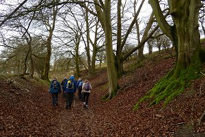
From Sydmonton, we headed back up on to the ridge-way through a wooded tunnel of a path lined with ancient trees with moss growing on their roots. The path followed the edge of a natural bowl in the land, which was pasture to a number of sheep, and had a farm house at the bottom.
As we reached the top of the path, where it joined the Wayfarer's Walk, we were hit by the full force of the wind again, which accompanied us for the rest of our walk.
We followed the Wayfarer's Walk going east along the top of Watership Down and past some more gallops back to the car park at White Hill. See our route on Bing Maps.

As this walk had been a last minute substitution, I hadn't had time to pre-walk the route before leading it. The walk included many paths that I know well around this area, but also included a few that I had never walked on before, so I was concentrating more on navigating and less on chatting today!

📸 Back to Volume 7
Return to volume index