
Sixteen people turned up on Saturday 28th December for our last walk of the year. Two of these were guests from the North Hampshire ramblers group and another was trying us out with a view to joining. The weather was sunny, but a little cold at 6°C, with none of the wind and rain we've had recently.
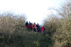
We set off from the car park at the top of White Hill and followed the Wayfarer's Walk, gently up hill, along the top of Watership Down. After about a mile we crossed the gallops, giving way to a solitary horse rider and began to descend the steep slope on the north side of the down.
Cutting through a piece of woodland, we followed a couple of muddy footpaths (with ice on some of the puddles) and joined the lower gallops. No horses on these gallops - just dog walkers. A bit of road walking took us east, through the southern tip of Kingsclere village and on to a track called Hollowshot Lane.
After about a mile, we left the track and turned south, following a footpath that led us up Cottington's Hill. As the path levelled out near the top, we stopped for our picnic lunch. After lunch we continued on our way to Hannington village, which involved more ups and downs, and quite a bit of mud.
On reaching the pretty village of Hannington, we made our way to the Vine pub. Muddy boots were removed (or covered in plastic overshoes) before entering the pub, so as not to ruin the carpet.
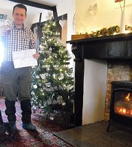
Inside was a wood-burning stove belting out some welcome heat. Sitting on a leather settee by the fire with a pint in my hand, there was a great temptation to stay, but we finished our drinks and continued our walk.
Boots back on, we left the pub, heading past the green and the church before taking a footpath north out of the village. A bit more road-walking took us back to Cottington's Hill and to the TV transmitting station, whose mast could be seen throughout most of this walk. From there it was less than a mile, down-hill, back to the car park.
Although we encountered a few fallen branches on our route, there were fewer than expected considering the recent storms. With a total of 270m (880ft) of ascent over the 8 mile walk, we had a good work-out and hopefully burned a few of those Christmas calories. See our route on Bing Maps.

Return to volume index