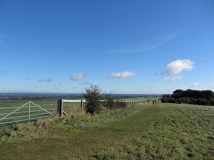
On Saturday 6th October, our thirteenth walk was held jointly with the Berkshire Walkers 20s & 30s group and was another figure-of-eight walk, with an option to finish after 8 miles instead of the full 13½. We had eleven people on the first part of the walk and five on the second.
The weather was sunny with clear blue skies, although heavy rain the previous night had made it wet underfoot in places.
The walk began at the White Hill car park and headed west along the Wayfarer's Walk across Watership Down, Nuthanger Down to Ladle Hill. The hill-fort at Ladle Hill is believed to be an example of an 'unfinished' hill-fort on the site of an earlier Bronze Age settlement. It also seemed to be a popular spot for the sheep and gave a commanding view of West Berkshire to the north, Beacon Hill to the west, and North Hampshire to the south.
We followed the Wayfarer's Walk a bit further south-west before leaving it for a footpath heading north down the hill to Wergs Farm. From there we walked through Sydmonton and back up hill to Nuthanger Down, stopping off for our picnic lunch on the way.

We then headed back the way we came along the Wayfarer's Walk, across Watership Down, to the car park where we had started. At this point those that only wanted an 8 mile walk left us.
The second half of the walk continued along the Wayfarer's Walk until we reached North Oakley, where we left it and took a footpath to Hannington. We stopped off at The Vine public house for a refreshing drink before carrying on into Hannington village.

We passed the village green and All Saint's Church before leaving Hannington on a footpath and then a lane that took us to Cottington's Hill, which is dominated by a television transmitter mast. Then we descended back to the car park having covered just over 13½ miles with a total of 629 metres of ascents. Quite a good workout! See our route on Google Maps.

Return to volume index